29. An Old Manor Map. Doddington in the early 17th century, with accompanying transcripts and text by Evelyn Lord, William Franklin and David Edwards
£24.00
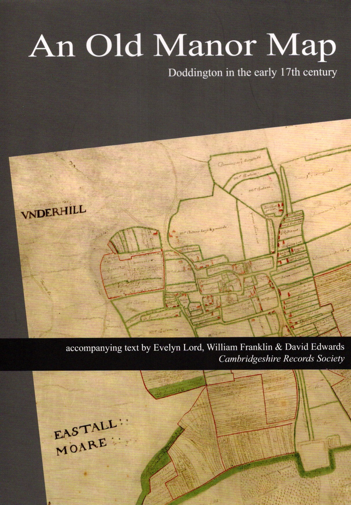
An extraordinarily detailed map of Doddington and its hamlets including the town of March.
ISBN: 978 0 904323 31 3
Published: 2024
This publication provides immediate access to a map that has been known about for long time but only in a monochrome photograph and had briefly disappeared. The map is here reproduced in colour in four conveniently folded overlapping sheets, for Doddington, Wimblington and Eastwood End, March south (the ancient centre around the church) and north (‘Marchford’ around the river crossing), each sharply focused. Complementing this is a booklet discussing the maker of the map, identified as likely to be William Hayward, and describing its history and value for Doddington, March and other villages covered by the manor. Particularly useful are the enlargements of the village centres with tables of occupiers. The date and purpose of the map are discussed with an examination of the roles of the Peyton and Balam families and transcripts of several contemporary documents, with indexes of persons and places. The publication is contained within an A4 folder with two facing sleeves that sits easily upon a bookshelf, matching that of the society’s previous publication, Jonas Moore’s Mapp of the Great Levell 1658.
The publication is the result of a team effort between William Franklin (see Agriculture in Cambridgeshire), Evelyn Lord, former Senior Local History Tutor for Cambridge University Institute of Continuing Education and an emeritus fellow of Wolfson College, and David Edwards, archivist to the March Museum.